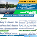
A study of hydrological extremes from space
Name of the Speaker: Prof. Venkataraman Lakshmi
Title of the Seminar: A study of hydrological extremes from space
Date and Time: 14th June 2024 (Friday), 04:00 pm
Online Platform: MS Teams (link to the video of the seminar)
About the Speaker:
Prof. Venkataraman Lakshmi graduated from the University of Roorkee in 1987 with a bachelor’s degree in civil engineering and a Doctorate in Civil and Environmental Engineering in 1996 from Princeton. He worked at NASA Goddard Space Flight Center from 1996-1999 as a research scientist in the Laboratory for the Atmospheres. His areas of research interest are catchment hydrology, satellite data validation and assimilation, field experiments, land-atmosphere interactions, satellite data downscaling, vadose zone, and water resources. He is currently the John L Newcomb Professor of Engineering in the Department of Civil and Environmental Engineering at the University of Virginia. He has served as Cox Visiting Professor at Stanford University 2006-2007 and 2015-2016 and Program Director for Hydrologic Sciences at the National Science Foundation (2017-2018).
Prof. Venkat is a fellow of the American Society of Civil Engineers (ASCE), Geological Society of America (GSA), American Society of Agronomy (ASA) and he has over 190 peer-reviewed articles and around 600 presentations and thesis supervisor for 25 graduate students. He is currently serving as editor for Vadose Zone Journal and the founding editor-in-chief of Remote Sensing in Earth System Science (Springer Journals). He has served on the National Academies Panel for the Decadal Survey of Earth Observations from Space (NASA) and as chair of the planning committee for Groundwater Recharge and Flow: Approaches and Challenges for Monitoring and Modeling Using Remotely Sensed Data (NGA). He is currently serving as a member of the Water Science and Technology Board, National Academy of Sciences and Vice-Chair of the Earth Science Advisory Committee for NASA. He is the President-Elect of the Hydrology Section of the American Geophysical Union
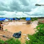
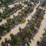
Abstract: Land surface hydrology is a collection of complex processes. The spatial variability both the land surface properties (soil and vegetation) as well as the meteorological inputs (precipitation and radiation) play an important role in hydrology. Satellite remote sensing has a broad spatial and repeat temporal view of the land surface and can provide observations for use in hydrology such as soil moisture, surface temperature, and vegetation density. The variability of the water cycle causes extremes such as droughts and floods and these have an impact on society. In addition, landslides and permafrost thaw are the two other hydrological extremes that impact society. In the past two decades with the advent of improved satellite sensors, modeling, and in-situ observations, quantification of the water cycle and its extremes has become possible. These satellite sensors include – microwave observations for soil moisture and precipitation; visible/near-infrared for vegetation and evapotranspiration, gravity for groundwater/total water, and thermal observations for surface temperature. In this talk, I will focus on using models, satellites, and in-situ observations for hydrological variability specifically as they relate to hydrological extremes.
Date/Time
Date(s) - 14/06/2024
4:00 pm - 5:00 pm