Karnataka GIS : A tool towards transparent governance
Name of the Speaker: Dr. JayKumar PD (KSRSAC)
Title of the Seminar: Karnataka GIS : A tool towards transparent governance [Gallery]
Date and Time: 30th September, 2019 (Monday), 4:00 PM
Venue: Lecture Hall, ICWaR
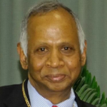
About the speaker: Dr. Jayakumar P D is a team lead for capacity building division at Karnataka State Remote Sensing Applications Centre, Department of Personnel and Administrative Reforms (e-Governance), Government of Karnataka. He has PhD on Remote Sensing and GIS from Dept. of Applied Geology, Kuvempu University. His research areas include Optical Remote Sensing and GIS applications for natural sector. He has more than 10 years of experience in private, government and research & development sector in geospatial technology.
Abstract: Karnataka Geographic Information System (K-GIS) is a flagship program of the state which is visualized as a geospatial technology platform that ensures availability of updated “GIS ready data” of specified standard. It is a novel initiative by the Karnataka State Remote Sensing Applications Centre (KSRSAC) to map and integrate all department asset data and make it available for both government and public through a single gateway i.e., K-GIS Portal (https://kgis.ksrsac.in/kgis/). The datasets are organized and standardized such that they are readily available, easily-usable “integrated” GIS content for the entire state. The major activities of K-GIS are mapping and geo-tagging of departmental and public assets, integration of MIS data and developing GIS based Decision Support System to address the spatial challenges of Government of Karnataka (GoK) departments. Till date more than 18 lakhs asset related information was collected and organized in 350 spatial layers and the activity is growing. By using these spatial data around 40-45 GIS based mobile applications (Ex: Moulya, Dishaank, Chunavana, Data Collector etc.,) and around 50-55 GIS based web applications (Ex: Agriculture Dept, Family Welfare Dept, Education Dept etc.,) were developed and rolled out for department and citizen usage. It has also tailored the departmental applications with GIS content for taking decisions, tracking project implementation, monitoring progress and policy definition. Due to its implementation by GoK, all the government institute/infrastructure data and MIS information is available to the citizens, thus facilitating the Right to Information in a user-friendly manner. The maps are also available as a service to IT enthusiast and researcher to carryout research and development activities.
Date/Time
Date(s) - 30/09/2019
4:00 pm
